Overview
As a part of weather forecasting, the Estonian Environment Agency also prepares overviews of ice conditions. We update the ice chart daily with changes in the ice situation in our marine areas – identifying ice types and phenomena and adding estimated ice thicknesses. The same ice chart also includes information on icebreakers and the navigation requirements from the Transport Administration. The completed ice map can be viewed in the interactive web application at jaakaart.envir.ee. This is a seasonal map application, which is usually active from December to March, though the period may be extended depending on ice conditions.
From the 2024/25 season, the web application also includes inland water ice conditions measurements provided by the Rescue Board, which can be viewed in the 'Current Situation' section.
More information
Remote sensing data is used in the preparation of the ice map
The advanced interactive web application jaakaart.envir.ee allows you to explore ice maps created for the latest season. The map also displays ice observations and the latest satellite images. When preparing the ice map, we use detailed radar-based Sentinel-1 satellite data, which allows us to see changes in ice conditions in Estonian marine areas both at night and during the day and even in cloudy weather. In addition to the radar-based satellite information, other satellite data also reach ice map web application. The Sentinel-2 and Sentinel-3 satellites perform measurements by optical instruments which make it difficult to detect ice in cloudy weather or without daylight. However in a clear sky conditions, this data helps to estimate the extent of sea ice.
The ice monitoring system based on remote sensing allows us to identify different types of sea ice (fast ice, close ice, open ice, new ice, etc.) and ice phenomena (ridges and polynyas) and can also monitor ice conditions on larger lakes. Remote sensing data can be used to estimate the extent of the ice cover and the dynamics of ice conditions.
However, remote sensing data does not provide a complete overview of the ice conditions which is why in situ ice observations are so important. Ice thickness observations, collected through the national weather app ILM+ and the ice observation submission form (in Estonian), are also visible in the web application. To collect reliable ice observation data, an agreement has been made with the Rescue Board.
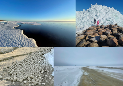
Calling all active weather enthusiasts! The national weather app ILM+, developed by Estonian Environment Agency, not only allows you to monitor various weather information and warnings, but it also enables anyone to submit observations, including ice observations. Submitted ice observations will appear simultaneously on both the mobile app and the web map application. You can also add photos to your ice observations, which provide added value when estimating ice conditions. Alternatively, ice observations can be submitted through a web form, but in this case, the ice observations will only appear in the map application. This allows us to gather more information about ice conditions and receive fascinating images of various ice phenomena. Please, be careful when making ice observations.
Who are the users of ice information in Estonia?
Ice maps prepared by the Estonian Environment Agency are used to plan the optimal routes of ships and icebreakers, helping save time and fuel. In the harshest winters, when all our marine areas are covered with ice, 20–30 icebreakers may be working simultaneously across the entire Baltic Sea.
The ice information we publish is eagerly followed by weather enthusiasts and fishermen looking forward to the winter fishing season as well as winter sports enthusiasts for activities like ice surfing or ice skating. Ice information is also used to grant permission to go on the ice or, conversely, to ban it, as well as to plan ice roads in stable cold weather conditions. In some cases, it is even used to rescue people faster. For this, the Estonian Environment Agency works together with the Rescue Board, the Police and Border Guard Board and the Transport Administration.
Find out more: Ship traffic in the Baltic Sea can be monitored using the MarineTraffic map application. The application displays the locations and movement of ships in marine areas, and you can also view the real-time location of the icebreakers. For example, try to find the location of the icebreaker ‘EVA-316’, which helps ships reach the port of Pärnu, and check the locations of the icebreakers ‘Tarmo’ and ‘Botnica’, which assist ships in reaching the ports of the Gulf of Finland, if necessary.
Use the navigation feature on the map to locate the ships and their exact positions. Different ship types are marked in different colors. Legends and the option to display vessel types can be found under the ‘Vessel filters’ button on the right side of the menu. Icebreakers are located under the ‘Tugs and special craft’ layer.
International cooperation to provide ice information
The purpose of the Baltic Sea ice services is to provide a comprehensive set of ice products and services for the Baltic Sea marine areas, tailored to meet the the needs of users and provide a better basis for decisionmaking, thereby contributing to the navigation safety. The collaboration between the Baltic Sea ice services and the shared aims of the teams ensure the high quality of services.
The ice services exchange ice information on daily basis. Before preparing the ice map and report, they analyse the entire Baltic Sea’s ice information to understand the extent of the ice cover. This also helps them to predict how the ice conditions may change in the near future, taking into account the weather forecasts. General information on the Baltic Sea ice services along with the latest ice information from each ice service can be found at www.bsis-ice.de.
In every two or three years, the Baltic Sea Ice Meeting takes place, where specialists from different countries share their experiences from past ice seasons, introduce their services and explore new ways to improve ice information in the Baltic Sea region. The ice services of Finland and Sweden are interested in the ice information system developed by the Estonian Environment Agency, as it is the only online application that combines daily remote sensing data ice maps, and observations all in one place.
The ice map is created using a specially developed QGIS ice map plugin, which gathers remote sensing data for the past three days, along with observations mainly received from the ILM+ mobile application and other publicly available ice data. The ice map specialist selects the source of ice information for each marine area, and based on this data, compiles the ice map, also adding information on navigation restrictions and icebreakers from the Transport Administration.
The Estonian Environment Agency prepares and sends a daily report on the ice conditions in Estonian marine areas and on waterways. The ice report provides the same information as the ice map, but in coded numerical form and a detailed text description. The data describing the ice conditions is encoded using the Baltic Sea Ice Code, based on the World Meteorological Organization's Sea Ice Nomenclature and used by all Baltic Sea Ice Services. This is the most efficient and fastest way to share ice situation information for marine areas. The daily ice report includes also the locations of polynyas, ice drift directions and navigational restrictions.